The tiniest and the most heavily populated country of Central America, El Salvador has a total area of 21041 sq km. It is bordered north and west by Guatemala, north and east by Honduras and south by the Pacific Ocean with a coastline of some 300 km.
Four imposing volcanoes – San Salvador, San Miguel, San Vicente and Santa Ana – rise near the cities bearing the same names, and a relatively new volcano, Izalco, stands near Sonsonate. A number of volcanic craters enclose scenic lakes. The uplands of the country are volcanic featuring two almost parallel volcanic ranges. The highest volcanoes are Santa Ana at 2365 m, San Vicente at 2182 m and San Salvador at 1943 m. The Volcanic activity has produced a thick layer of ash and lava on the highlands, creating a richly mineralized soil ideal for coffee planting.
On the country’s longest river, the Rio Lempa, the 800 m wide hydroelectric Cerrón Grande dam provides power to much of the country. Fed by rivers in Guatemala and Honduras, the Lempa flows in a broadly southern direction spreading into the BajoLempa flood plain before draining into the Pacific.
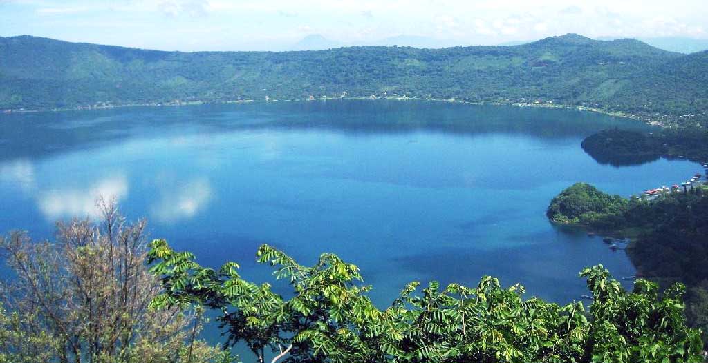
Lago De Llopango is the country’s largest natural lake with a surface area of 72 sq. km. Lieying to the east of San Salvador, this is a scenic crater lake with steeply scalloped banks. Of El Salvador’s other lakes, Lago De Coatepeque located in Santa Ana with a surface area of 26 sq. km, is the most notable and possibly the most scenic featuring hot springs. Rising up from Coatepeque watery blue crater is Isla Teopán where important Mayan artefacts have been discovered.
The mountain elevation provides a mild climate for much of the country. El Salvador has two seasons: summer or “verano” and winter “invierno”. Summer, which runs from November through April, is both hot and dry. Winter, which runs from May through October, is the rainy season with the heaviest rains in September and October.
The beaches and lowlands are warm – generally between 18 degrees Celsius and 32 degrees Celsius. The coolest months are November and December, while the warmest are March and April. The mountains, including the “Ruta de las Flores”, El Pital Highlands and Morazán Department, can be chilly. In fact it has been known to snow atop Cerro Pital.
For most travelers, it is best to visit during the dry season and to avoid the hottest time of the year (March, April) when humidity levels are particularly high. Surfers, however, should aim for April to October.